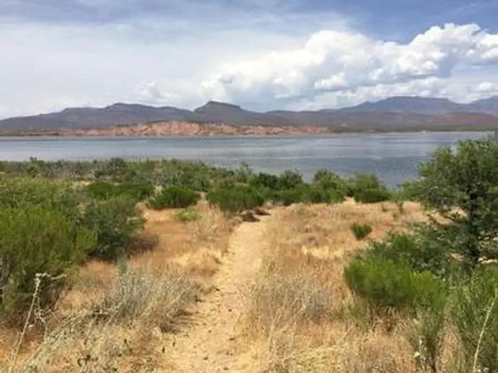
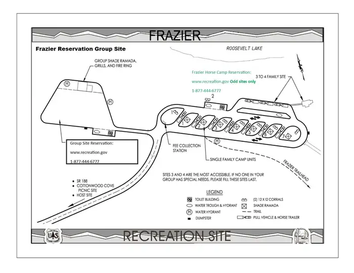

The campground overlooks Roosevelt Lake and is nestled in the saguaro cactus-studded Sonoran Desert.In addition to camping, horseback riders, hikers, and mountain bikers can access the Arizona National Scenic Trail from the campground via the Frazier Trail. There are many other trails in the area.Frazier’s large open parking area accommodates trailers and pull vehicles arranged in a variety of parking configurations. Facilities include vault toilets, a shelter with group-sized picnic tables, grills, and fire rings, a watering trough, and water hydrants.At an elevation of 2,200 feet, the group site has stunning views of the blue water and sunsets against three mountainous wilderness areas.Multiple opportunities for enjoying spectacular scenery and learning about the area’s pre-history, history, flora, fauna, or geology include visiting Tonto National Monument cliff dwellings (National Park Service), driving portions of the Apache Trail Historic Road (State Hwy 88) and Desert to Tall Pines Scenic Road (State Hwy 288) or visiting the Tonto Basin Visitors Center.
Verified facts
RIDB / Recreation.gov official databaseAmenities
RIDB /facilities /campsites · owner-verifiedStraight talk
CamperWatch intel · curated from camper reportsKnown issues, each with the workaround. Read before you book.
Insider tips & when to go
CamperWatch intel · hand-curated entryBook early
this is a federal campground with limited availability.
Only 1 tent site available; verify availability before traveling.
Access Arizona National Scenic Trail and multiple hiking/biking trails from the campground via Frazier Trail.
Campground operates seasonally May through October only.
Things to do nearby
RIDB /activities /recareas + intelConditions today
LiveCell signal
FCC BDC · quarterly datasetFCC maps are theoretical — camper reports confirm signal. Best carrier: AT&T.
Wildlife nearby
iNaturalist · research-grade · 8 kmLocation
Leaflet · OpenStreetMap tiles


Getting there →
From Phoenix: Take State Hwy 87 / Beeline Highway north for about 75 miles to its junction with State Hwy 188. Turn right and follow State Hwy 188 for 33.5 miles to the site (just after the visitor center on the left, watch for campground sign). From Mesa: Take State Hwy 87 / Beeline Highway north for about 61 miles to its junction with State Hwy 188. Turn right and follow State Hwy 188 for 33.5 miles to the site (just after the visitor center on the left, watch for campground sign). From Globe
Campground entrance
Google Maps APICommunity
#community · posts, photos & Q&A · AI-moderated (Claude Vision)Pro tips
- Book on recreation.gov exactly 6 months ahead at 10am ET — Tonto National Forest fills fast in peak season.
- Check current road conditions at Tonto National Forest before arrival — seasonal closures common.
Frequently asked questions
RIDB facts + intel · FAQPage schema, speakableHow much does Frazier Group Campground cost per night?+
What season is Frazier Group Campground open?+
Does Frazier Group Campground have hookups?+
What is the maximum RV length at Frazier Group Campground?+
How do I make reservations at Frazier Group Campground?+
What is the cell service like at Frazier Group Campground?+
What season is Frazier Group Campground open, and what are check-in times?+
●Data sources on this page
CamperWatch never fabricates data. Where data is unavailable, it is not shown.
Nearby Campgrounds
Own a campground nearby?
List free on CamperWatch — we take 5% only on bookings we send. No monthly fee.