
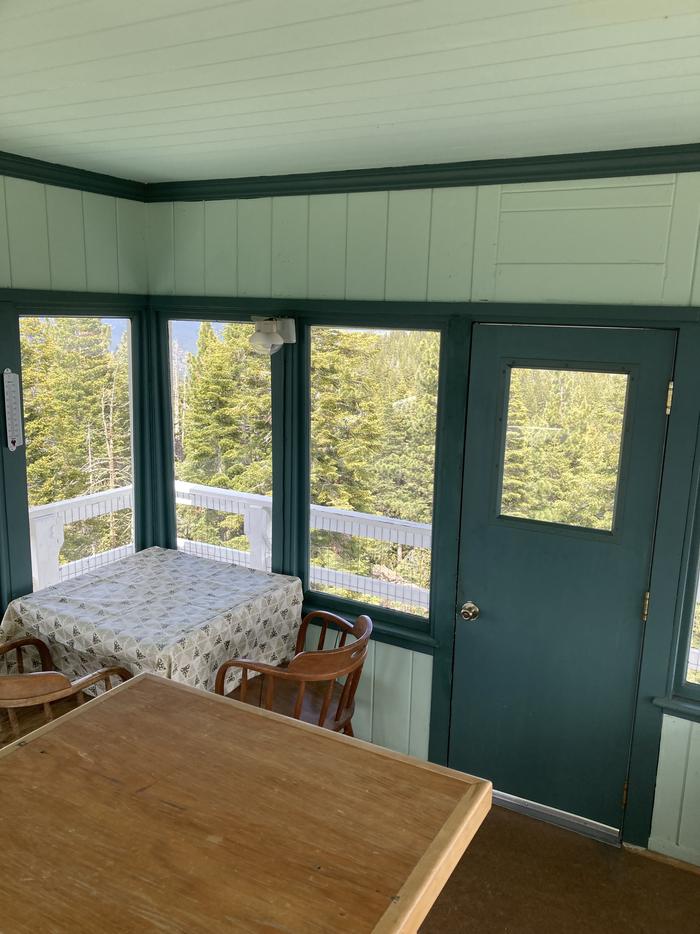
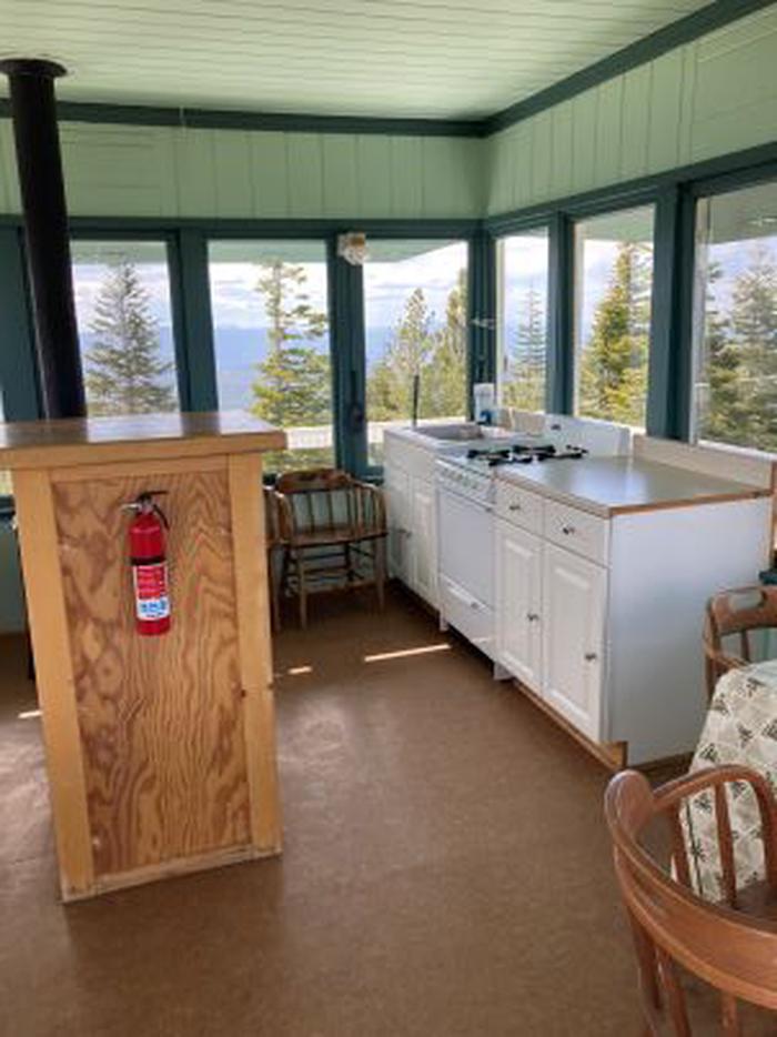
Sardine Peak is a forest fire lookout tower that was constructed in 1935 by the Civilian Conservation Corps. It is a three story enclosed tower with external stairs. Presently the top room or observation cab is the only rentable space.
Verified facts
RIDB / Recreation.gov official databaseAmenities
RIDB /facilities /campsites · owner-verifiedStraight talk
CamperWatch intel · curated from camper reportsKnown issues, each with the workaround. Read before you book.
Insider tips & when to go
CamperWatch intel · hand-curated entryHigh clearance vehicle recommended for final approach road; verified 2WD vehicles can make it but tight clearance
Final 1/10 mile requires walking; gate normally locked
Narrow external stairs
plan accordingly for mobility
Official seasonal operating period per verified data.
Things to do nearby
RIDB /activities /recareas + intelConditions today
LiveCell signal
FCC BDC · quarterly datasetFCC maps are theoretical — camper reports confirm signal. Best carrier: T-Mobile.
Wildlife nearby
iNaturalist · research-grade · 8 kmLocation
Leaflet · OpenStreetMap tiles


Getting there →
From the Sierraville Ranger District Office, proceed south on Highway 89 for 12 miles to Sierra County Road S450. Turn left onto road S450 and proceed east for 4 miles to Sierra County Road S650, the Lemon Canyon Road. Turn left onto County Road S650 and proceed north for 2 miles to Forest Service Road 650-75, the Sardine Peak Lookout Road and proceed 4 miles to the locked gate. Sardine Peak Lookout is about 250 yards beyond the locked gate.
Campground entrance
Google Maps APICommunity
#community · posts, photos & Q&A · AI-moderated (Claude Vision)Pro tips
- Book on recreation.gov exactly 6 months ahead at 10am ET — Tahoe National Forest fills fast in peak season.
- Check current road conditions at Tahoe National Forest before arrival — seasonal closures common.
Frequently asked questions
RIDB facts + intel · FAQPage schema, speakableHow much does Sardine Peak Lookout cost per night?+
What season is Sardine Peak Lookout open?+
Does Sardine Peak Lookout have hookups?+
What is the maximum RV length at Sardine Peak Lookout?+
How do I make reservations at Sardine Peak Lookout?+
What is the cell service like at Sardine Peak Lookout?+
What season is Sardine Peak Lookout open, and what are check-in times?+
●Data sources on this page
CamperWatch never fabricates data. Where data is unavailable, it is not shown.
Nearby Campgrounds
Own a campground nearby?
List free on CamperWatch — we take 5% only on bookings we send. No monthly fee.